Introduction
Recently, while researching Cosmos DB, I came across the in-built capabilities for managing spatial data.
Cosmos DB is Microsoft’s globally distributed, multi-model database. It has the capability to store various types of data, such as document, graph and key-value and can elastically scale to cope with varying needs. The piece of Cosmos DB that this post will be discussing is the spatial capabilities of the document model.
The problem I have chosen to solve using the spatial functionality is working out which airfields are within the range of an aircraft when given its true airspeed and fuel endurance in hours; with the range being calculated by multiplying the airspeed by the endurance.
The Data
The first step was to find a data set containing a list of all of the world’s airfields, this was found on GitHub at https://github.com/mwgg/Airports. The data set contains the details we need, which are:
- ICAO code – this is the unique identifier for an airport
- Airport Name
- Latitude and Longitude of the Airport
The next step was to create a Cosmos DB account in the Azure Portal and write a C# app to do some transformations on the data and load the documents into our Cosmos DB collection.
I first created a C# object that matched the structure of the JSON data:
using Newtonsoft.Json;

namespace LoadAirportData
{
    public class Airport
    {
        [JsonProperty("id")]
        public string Id => this.Icao;

        [JsonProperty("icao")]
        public string Icao { get; set; }

        [JsonProperty("iata")]
        public string Iata { get; set; }

        [JsonProperty("name")]
        public string Name { get; set; }

        [JsonProperty("city")]
        public string City { get; set; }

        [JsonProperty("state")]
        public string State { get; set; }

        [JsonProperty("country")]
        public string Country { get; set; }

        [JsonProperty("elevation")]
        public int Elevation { get; set; }

        [JsonProperty("lat")]
        public double Latitude { get; set; }

        [JsonProperty("lon")]
        public double Longitude { get; set; }

        [JsonProperty("tz")]
        public string TimeZone { get; set; }
    }
}
I then created a C# object that matched the structure of the document I wanted to insert into Cosmos DB. The “Point” data type is used to serialize the latitude and longitude into the GeoJSON structure that Cosmos DB supports:
using Microsoft.Azure.Documents.Spatial;
using Newtonsoft.Json;

namespace LoadAirportData
{
    public class AirportDocument
    {
        public AirportDocument(Airport airport)
        {
            Id = airport.Icao;
            Iata = airport.Iata;
            Name = airport.Name;
            Location = new Point(airport.Longitude, airport.Latitude);
        }

        [JsonProperty("id")]
        public string Id { get; set; }

        [JsonProperty("iata")]
        public string Iata { get; set; }

        [JsonProperty("name")]
        public string Name { get; set; }

        [JsonProperty("location")]
        public Point Location { get; set; }
    }
}
Finally I created a method that dropped the Cosmos DB database, recreated the database and the document collection then loaded the documents into the collection:
using Microsoft.Azure.Documents.Client;
using System;
using System.Collections.Generic;
using System.Linq;
using System.Text;
using System.Threading.Tasks;
using Microsoft.Azure.Documents;
using Newtonsoft.Json;
using System.Net;
using System.Collections.Concurrent;

namespace LoadAirportData
{
    public class CosmosDbImporter
    {
        private const string ENDPOINT_URL = "";
        private const string PRIMARY_KEY = "";

        private const string DATABASE_NAME = "airports";
        private const string COLLECTION_NAME = "airportData";

        private const string IMPORT_PATH = @"C:TempAirports.json";

        public async Task ImportData()
        {
            var documentClient = new DocumentClient(new Uri(ENDPOINT_URL), PRIMARY_KEY);

            // Delete the database if it exists
            try
            {
                await documentClient.DeleteDatabaseAsync(UriFactory.CreateDatabaseUri(DATABASE_NAME));
            }
            catch (DocumentClientException ex)
            {
                if (ex.StatusCode != HttpStatusCode.NotFound)
                    throw;
            }

            // Create the Database
            await documentClient.CreateDatabaseIfNotExistsAsync(new Database() { Id = DATABASE_NAME });

            // Create the collection and switch on spatial indexing
            DocumentCollection collection = new DocumentCollection() { Id = COLLECTION_NAME };
            collection.IndexingPolicy = new IndexingPolicy(new SpatialIndex(DataType.Point));

            await documentClient.CreateDocumentCollectionIfNotExistsAsync(UriFactory.CreateDatabaseUri(DATABASE_NAME), collection);

            // Read the file and deserialize to our Airport object
            var data = System.IO.File.ReadAllText(IMPORT_PATH);
            var airports = JsonConvert.DeserializeObject<Dictionary<string, Airport>>(data);

            // Upload documents to CosmosDB
            await Task.WhenAll(
                from partition in Partitioner.Create(airports.Values).GetPartitions(50)
                select Task.Run(async delegate
                {
                    using (partition)
                    {
                        while (partition.MoveNext())
                        {
                            Console.WriteLine($"Processing {partition.Current.Icao}");

                            var airportDocument = new AirportDocument(partition.Current);
                            await documentClient.CreateDocumentAsync(UriFactory.CreateDocumentCollectionUri(DATABASE_NAME, COLLECTION_NAME), airportDocument);
                        }
                    }
                }));
        }
    }
}
One thing to note is the above code enables spatial indexing when creating the collection, without this enabled performance is extremely poor when performing spatial queries.
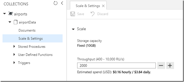
The beauty of Cosmos DB is that it is able to elastically scale to the performance level specified by the user through the number of RUs (request units) that are allocated to the collection. While loading the data into Cosmos DB I wanted to scale up my database to take advantage of the multithreading in my C# app and speed up my processing so I just went in to the Azure Portal and adjusted the number of RUs allocated to the collection, the change was almost instant and my process instantly sped up. Once I had finished importing the data I was able to scale my database back down so I’m no longer paying for any unused capacity.

Querying
Now the data is in Cosmos DB we can begin to play around with some spatial queries.
To query airfields within a certain distance of a specified point I can run the following query which returns all of the airfields within 25km of Blackbushe airport. As you can see, the SQL syntax for querying Cosmos DB is very similar to T-SQL meaning it’s very easy to re-use your SQL Server skills:
SELECT  airports.id AS ICAO,
        airports.name AS Name,
        ST_DISTANCE(airports.location, {"type": "Point", "coordinates": [-0.8475000262,51.3238983154]}) AS Distance
FROM    airports
WHERE   ST_DISTANCE(airports.location, {"type": "Point", "coordinates": [-0.8475000262,51.3238983154]}) < 25000
The above query returns the following results, which are the 7 airfields that are within 25km of Blackbushe:
[
    {
        "ICAO": "EGHL",
        "Name": "Lasham Airport",
        "Distance": 19964.7890768588
    },
    {
        "ICAO": "EGVO",
        "Name": "RAF Odiham",
        "Distance": 11985.957064869535
    },
    {
        "ICAO": "EGTF",
        "Name": "Fairoaks Airport",
        "Distance": 20229.321025944442
    },
    {
        "ICAO": "EGLF",
        "Name": "Farnborough Airport",
        "Distance": 7286.035340157135
    },
    {
        "ICAO": "EGLK",
        "Name": "Blackbushe Airport",
        "Distance": 0
    },
    {
        "ICAO": "EGLM",
        "Name": "White Waltham Airfield",
        "Distance": 20312.693531316185
    },
    {
        "ICAO": "EGLP",
        "Name": "Brimpton Airfield",
        "Distance": 23311.94703537874
    }
]
The App
The next step is to create an application that uses the functionality to find the airfields within the range of an aircraft. To do this I created a basic ASP.NET MVC application that has a form with the following fields:

When the form is submitted the following C# code is executed:
[HttpPost]
public async Task Index(AirportFinderModel model)
{
	var documentClient = new DocumentClient(new Uri(ENDPOINT_URL), PRIMARY_KEY);

	var baseAirfield = await documentClient.ReadDocumentAsync(UriFactory.CreateDocumentUri(DATABASE_NAME, COLLECTION_NAME, model.BaseAirfield));

	var availableDistanceMeters = (model.EnduranceHours * model.TrueAirspeed) * 1852;

	var result =
		documentClient
		.CreateDocumentQuery(UriFactory.CreateDocumentCollectionUri(DATABASE_NAME, COLLECTION_NAME))
		.Where(a => a.Location.Distance(baseAirfield.Document.Location) <= availableDistanceMeters) .ToList(); return View("Result", new AirportFinderResultModel() { MapPoints = JsonConvert.SerializeObject(result.Select(a => new MapPoint()
		{
			Title = a.Id,
			Description = a.Name,
			Longitude = a.Location.Position.Longitude,
			Latitude = a.Location.Position.Latitude
		}))
	});
}
The above code connects to Cosmos DB and retrieves the details for the base airfield that was specified, it then calculates the range of the aircraft in meters by multiplying the endurance (in hours) by the true airspeed in knots (nautical miles per hour) and then multiplying that my 1852 (number of meters in a nautical mile). A Linq query is then run against Cosmos DB using the built-in spatial functions to find airfields within the specified distance. The result is then converted into a JSON array that can be understood by the Google Maps API that is being used on the client side.
The client side uses the Google Maps API to plot the airfields on a map, giving us a view like the one below when given a base airfield of Blackbushe (EGLK), a true airspeed of 100kts and an endurance of 4.5 hours:

The current functionality of the app is extremely basic but could easily be expanded to make the range calculation more accurate by looking at wind and other factors that can affect range. This could be done by creating a polygon representing our range and then using the ST_WITHIN function to find all airfields within that polygon. The functionality could also be enhanced to take into account other attributes of the airfield by deciding if an airfield is suitable based on runway length and other facilities.
Conclusion
As you can see, using Cosmos DB it is extremely easy to analyse spatial data and the elastic scaling capability allows you to easily increase capacity of your application to cope with increased usage and large amounts of data. The spatial capabilities of Cosmos DB can make it a viable alternative to other databases such as SQL Server that aren’t always as easy to scale on demand and don’t have the flexibility that a document model can give.
As always, if you have any questions or comments then let me know.


Short and concise article, thanks! It was a good read.
On a separate note, the JPG image of Google Maps seems to show that there are 1000’s of airports…is something wrong with the query?